
Situational Awareness & Live Map
Situational Awareness and Geospatial Visualisation
In a crisis the map is not a picture; it is the shared truth. Everyone looks at the same ground: what is where, who is where, and how to get there.
- Operational Resilience Platform
- Network-Independent Communications
- Real-Time Crisis Management
- Powered by Türkiye's first underground data centre infrastructure
- Backed by the Ministry of Industry and Technology
How it works
Four layers, one ground. The city sits underneath; critical points, live teams and routing ride on top.
- Ground
One shared ground first.
The master map and the geospatial visualisation layer give the whole organisation the same ground. If teams look at different maps, they argue about the same incident in two different places.
- Layers
The ground knows what you are looking for.
Critical point and assembly area maps (plus hospital, pharmacy, fuel and safe area layers) ride on top of the ground. Layers turn on and off: the map does not get crowded.
- Live
The map shows what is happening.
Field team visibility carries who is where onto the ground; earthquake and field visibility keep the situation on the same screen. What you see is current, not a report.
- Routing
Seeing is not enough; you have to get there.
Route planning and guidance move the team to the point. Positioning does not depend on a single method: when the primary source drops, fallback mechanisms take over.
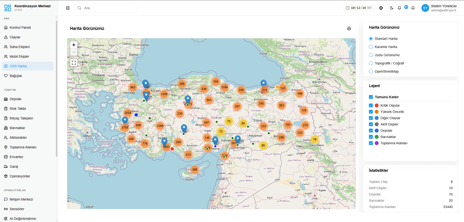
The shared ground, on screen.
The map view of the Coordination Centre: incidents, field teams, warehouses, shelters and assembly areas on the same ground. Layers turn on and off from the legend. Captured from the demo environment.
What changes
Everyone looks at the same ground.
Layers turn on; the map does not get crowded.
What you see is current, not a report.
Positioning does not depend on a single method.
Let's talk about your organisation's resilience.
See E-Afet applied to your own scenario in a 30-minute demo.